|
|
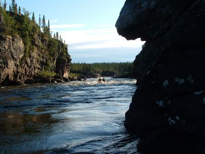
Pekans Canyon (R2)
|
George and Lew running R2 in Pekans Canyon
http://www.geocities.com/lester_kovac/moisie.htm
http://maps.google.com/maps?q=52+10+57.32N,66+52+1.95W&t=h&z=12
http://www.panoramio.com/map/#lt=52.182589&ln=-66.867208&k=2&z=8&tab=2
http://www.topozone.com/map.asp?lat=52.182589&lon=-66.867208&symshow=y&size=x&u=4&s=50&datum=nad83
|
|


![0513LK_[287]_Pekans_-_Moisie_portage.jpg](albums/userpics/10087/thumb_0513LK_%5B287%5D_Pekans_-_Moisie_portage.jpg "Filename=0513LK_[287]_Pekans_-_Moisie_portage.jpg
Filesize=304KiB
Dimensions=1280x960
Date added=Jan 18, 2008")


![0491LK_[291.9]_George_and_Lew_runnning_R2.jpg](albums/userpics/10087/thumb_0491LK_%5B291.9%5D_George_and_Lew_runnning_R2.jpg "Filename=0491LK_[291.9]_George_and_Lew_runnning_R2.jpg
Filesize=324KiB
Dimensions=1280x960
Date added=Jan 18, 2008")


