Home
Login
CCR Gallery
Photos from users of myccr.com
MyCCR Home Page
Album list
Last uploads
Last comments
Most viewed
Top rated
My Favorites
Search
Home
>
Canoe Routes
>
Quebec
FILE 1022/1104
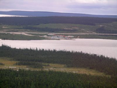
View of Lac Pau airbase
http://www.geocities.com/lester_kovac/leaf2007.htm
File information
Filename:
2470LC_View_of_Lac_Pau_base.jpg
Album name:
lllynette
/
Quebec
Rating (1 votes):
(
Show details
)
Keywords:
Pau
/
Caniapiscau
Photo Credit:
Lynette Chubb
Date:
August 20, 2007
Place Taken:
54:51:36.67 N 69:52:16.38 W
Route Name:
Charpentier/Leaf
Filesize:
165 KiB
Date added:
Feb 18, 2008
Dimensions:
1600 x 1200 pixels
Displayed:
358 times
Digital Zoom Ratio:
0
EXIF Image Height:
1200 pixels
FlashPix Version:
version 1
ISO:
64
Resolution Unit:
Inch
Saturation:
0
Y Resolution:
72 dots per ResolutionUnit
YCbCrPositioning:
Datum Point
URL:
http://gallery.myccr.com/displayimage.php?pid=1641
Favorites:
Add to Favorites