| Most viewed - Canoe Routes |

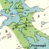
Albany River falls between miminiska and petawanga lakes655 viewsfrom the geological survey map 42e, 1933
|
|

Caribou lake, La Mauricie Nat'l park654 viewsOutdoor club, Montignac H.S., Lac-Mégantic, Quebec
|
|

Outer Foxes654 views
|
|

Riviere aux Feuilles654 views
|
|

Gens-de-terre river652 views
|
|

Day3 - Ashuapmushuan650 views
|
|

Ragged Falls on the Oxtongue River650 views
|
|

Upper La Chaudière Rapids - Ashuapmushuan648 views
|
|

Hayes Cliffs647 views
|
|

Loon Creek Lillypads646 viewsFarm Creek between Island Lk and Loon Lk ( aka Loon Creek) July 2004
|
|

Eramosa River, Good Friday 2009646 views
|
|

silver peak645 viewsa view of georgan bay from the top of silver peak. may 2003
|
|

Ragged Falls Warning Sign, Oxtongue River644 views
|
|

Algonquin_frog I644 views
|
|

Wolverine644 viewsWolverine along the Burnside River.
|
|

1947 truck at Devil's Lake end643 viewsPortage to Sheldon Lake. Truck used to haul stuff for the cottage owners
|
|

Portage from John to Kelsie crosses a swamp outlet via the old dam642 views
|
|

camping site #1640 views
|
|

Hayes River639 views
|
|

typical trail between John and Kelsie639 views
|
|

portage leading into Dusty from Mozhabong638 viewsthe first few 100m are across spagnum moss, but at this point the ground is reasonably firm just like a portage should be....
|
|

Two flat water canoeists trying to keep it afloat!638 viewsMy sister and I - I know, I know, get your hand up higher on the paddle! The water temp was almost like a bath water - good thing, we got wet a couple of times.
|
|

Caterpillar VII Rapid on Charpentier River638 viewshttp://www.geocities.com/lester_kovac/leaf2007.htm
|
|

Algonquin Park - - Access # 17 (other half of sign)638 views
|
|

Minesing Swamp during early spring flood.638 views
|
|

trail between John and Kelsie637 viewsmarked by cairns and blazes. In Spring 2009, they had been marked bright red
|
|

Spanish River West Branch, September 2005636 views
|
|

Oxford Lake635 views
|
|
![Filename=0768LK_[229]_Quiet_deep_water_canyon_on_Moisie.jpg
Filesize=320KiB
Dimensions=1280x960
Date added=Jan 18, 2008 0768LK_[229]_Quiet_deep_water_canyon_on_Moisie.jpg](albums/userpics/10087/thumb_0768LK_%5B229%5D_Quiet_deep_water_canyon_on_Moisie.jpg)
Quiet deep-water canyon on Moisie634 viewsBetween km 228 and 229 of Pekans/Moisie route, there is nice, quite narrow canyon. Water is very calm there, which means the river has to be very deep there.
http://www.geocities.com/lester_kovac/moisie.htm
http://maps.google.com/maps?q=51+46+56.3N,66+29+10.26W&t=h&z=12
http://www.panoramio.com/map/#lt=51.782306&ln=-66.486183&k=2&z=8&tab=2
http://www.topozone.com/map.asp?lat=51.782306&lon=-66.486183&symshow=y&size=x&u=4&s=50&datum=nad83
|
|

Portage to Eilnar Lake631 views
|
|
| 1380 files on 46 page(s) |
 |
 |
 |
 |
 |
 |
 |
 |
 |
 |
 |
13 |  |
 |
 |
 |
 |
 |
 |
 |
 |
 |
 |
|
