|
|
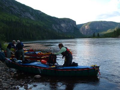
Moisie - Unloading at the campsite
|
Campsite on island at km 162, past confluence with Caopacho River.
http://www.geocities.com/lester_kovac/moisie.htm
http://maps.google.com/maps?q=51+17+52.17N,66+17+26.41W&t=h&z=12
http://www.panoramio.com/map/#lt=51.297825&ln=-66.290669&k=2&z=8&tab=2
http://www.topozone.com/map.asp?lat=51.297825&lon=-66.290669&symshow=y&size=x&u=4&s=50&datum=nad83
|
|


![2003LC_[16.5]_View_from_the_bridge_-_downstream.jpg](albums/userpics/10087/thumb_2003LC_%5B16.5%5D_View_from_the_bridge_-_downstream.jpg "Filename=2003LC_[16.5]_View_from_the_bridge_-_downstream.jpg
Filesize=415KiB
Dimensions=768x1024
Date added=Jan 18, 2008")
![0857LK_[217.3]_George_and_Lew_paddling_to_a_lunch_spot.jpg](albums/userpics/10087/thumb_0857LK_%5B217.3%5D_George_and_Lew_paddling_to_a_lunch_spot.jpg "Filename=0857LK_[217.3]_George_and_Lew_paddling_to_a_lunch_spot.jpg
Filesize=312KiB
Dimensions=1280x960
Date added=Jan 18, 2008")
![1142LK_[162.5]_Caopacho_River.jpg](albums/userpics/10087/thumb_1142LK_%5B162.5%5D_Caopacho_River.jpg "Filename=1142LK_[162.5]_Caopacho_River.jpg
Filesize=328KiB
Dimensions=1280x960
Date added=Jan 18, 2008")
![1152LK_[161.8]_Unloading_at_the_campsite.jpg](albums/userpics/10087/thumb_1152LK_%5B161.8%5D_Unloading_at_the_campsite.jpg "Filename=1152LK_[161.8]_Unloading_at_the_campsite.jpg
Filesize=322KiB
Dimensions=1280x960
Date added=Jan 18, 2008")
![1282LK_[134.5]_Fish_Ladder_Waterfall.jpg](albums/userpics/10087/thumb_1282LK_%5B134.5%5D_Fish_Ladder_Waterfall.jpg "Filename=1282LK_[134.5]_Fish_Ladder_Waterfall.jpg
Filesize=328KiB
Dimensions=1280x960
Date added=Jan 18, 2008")
![1581LK_[74]_Dan_and_Marilyn_paddling_Moisie.jpg](albums/userpics/10087/thumb_1581LK_%5B74%5D_Dan_and_Marilyn_paddling_Moisie.jpg "Filename=1581LK_[74]_Dan_and_Marilyn_paddling_Moisie.jpg
Filesize=322KiB
Dimensions=1280x960
Date added=Jan 18, 2008")
![0472LC_[292.5]_Marilyn_at_top_of_the_waterfall.jpg](albums/userpics/10087/thumb_0472LC_%5B292.5%5D_Marilyn_at_top_of_the_waterfall.jpg "Filename=0472LC_[292.5]_Marilyn_at_top_of_the_waterfall.jpg
Filesize=418KiB
Dimensions=1024x768
Date added=Jan 18, 2008")