| Last additions - Ontario |
Algonquin_frog II612 viewsSep 03, 2008
|
|

Algonquin_frog I896 viewsSep 03, 2008
|
|
Algonquin moose_I661 viewsSep 03, 2008
|
|
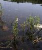
High water on Ezma Lake1103 viewsEven though it is in the middle of August 2008, the lake level is like in spring. The shrubs (meadowsweet) stand still in the water, and many trees along the shore (mostly cedars) have died as they could not tolerate the prolonged immersion.Aug 21, 2008
|
|
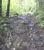
portage - worn from ATV use995 viewsthe tires loosen the surface and rain/spring run-off takes the soil awayAug 21, 2008
|
|
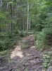
portage - with sawdust to smoothen the surface974 viewsprobably done by ATV crowd, to fill in soil that has eroded due to motorized useAug 21, 2008
|
|
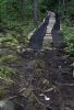
portage - with boards and worn skidoo tracks987 viewsprobably by ATV crowd, to counteract effects of erosion from ATV useAug 21, 2008
|
|
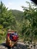
Old Baldy Mountain1043 viewsfrom portage Astonish to OlympusAug 20, 2008
|
|
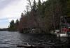
Ezma Lake - landing at portage to Ten Mile1029 views9 cached boats, including this pontoon monsterAug 20, 2008
|
|
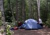
Camp site at Ezma L1053 viewsspacious and clean - even with a thunderboxAug 20, 2008
|
|
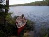
at campsite on Ezma Lake1067 viewsAug 20, 2008
|
|

Chuck Taylor was here....1045 views...maybe not, but his shoes shoes sure are useful!Aug 20, 2008
|
|
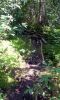
Portage from Astonish towards Olympus L948 viewsnote the arrangement of the supporting logs - traditional styleAug 20, 2008
|
|
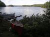
Portage from Dunlop Lake - landing at Ten Mile L1037 viewsAug 20, 2008
|
|
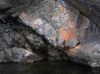
Brecchia in cliff (Island in Ten Mile LAke)999 viewsAug 20, 2008
|
|
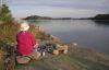
on Ten Mile Lake (N of Elliott Lake)1050 viewsAug 20, 2008
|
|
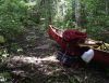
erosion on portage (Ten Mile L to Ezma)1036 viewsAug 20, 2008
|
|
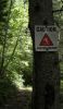
on Portage Ten Mile Lake to Ezma974 viewsAug 20, 2008
|
|

Public Landing at Dunlop Lake South Shore1071 viewsNear Elliott Lake.
The south shore has been sold off for cottage lots, and there is now a public landing about 2/3 down the lake. The road is signed as leading to "Dunlop Shores" and the new parking lot is near holds maybe 30 cars. There is a (mediocre) camp site right at the portage leading to Ten Mile Lake.Aug 19, 2008
|
|

Approach to Dunlop Lake from the south1130 viewspossible, but not sure: launch at Marsh, paddle through Summers and reach Dunlop via Green. The new developments on Dunlop's shore may prevent the last portage.
But the road that approaches Marsh serves the south shore of Dunlop and thus probably runs along most of that lake.Aug 13, 2008
|
|
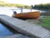
Opeongo Outfitters water taxi859 viewsat the dock on OpeongoJul 31, 2008
|
|
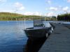
Algonquin Outfitters water taxi2530 viewsat the dock on OpeongoJul 31, 2008
|
|
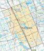
Wahta Reserve, near Parry Sound635 viewsNew boundaries of reserve since land claim settlement a few years backJul 17, 2008
|
|
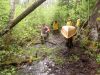
Stone Ara Port5452 viewsEnd of 1 mile port between Stone lake and Ara lake in Northern OntarioJul 02, 2008
|
|
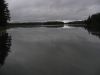
Algonquin_not a b&w photo787 viewsJun 19, 2008
|
|
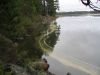
Pollen on the water919 viewsJun 19, 2008
|
|
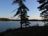
Algonquin sunset790 viewsJun 19, 2008
|
|

Calm Water857 viewsAfter being wind bound at the portage for 2 nights the lake turned to glass the next morning.Jun 16, 2008
|
|

"BIG RED"1185 viewsDave's 70 year old Thompson wood-canvas canoeJun 16, 2008
|
|

Shore Lunch797 viewsEnjoying shore lunch of freshly caught bass & walleye was norm for a day of bush wacking into a back lake.Jun 16, 2008
|
|
| 421 files on 15 page(s) |
 |
|
|
|
|
|
|
9 | |
|
|
|
|
|





